

Measured data on what flies over your facility.
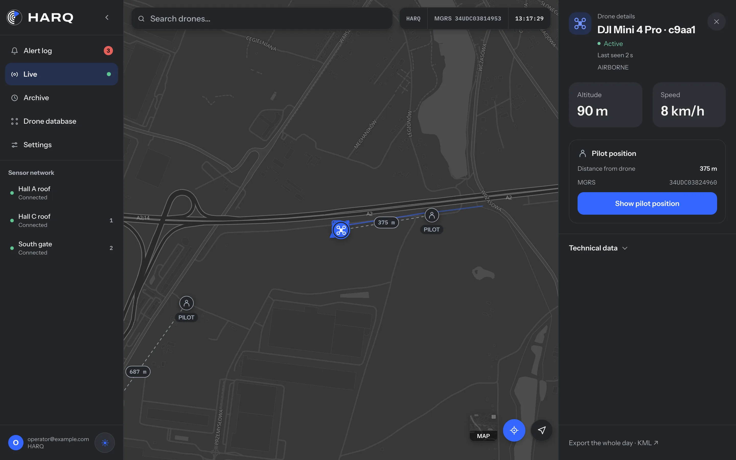
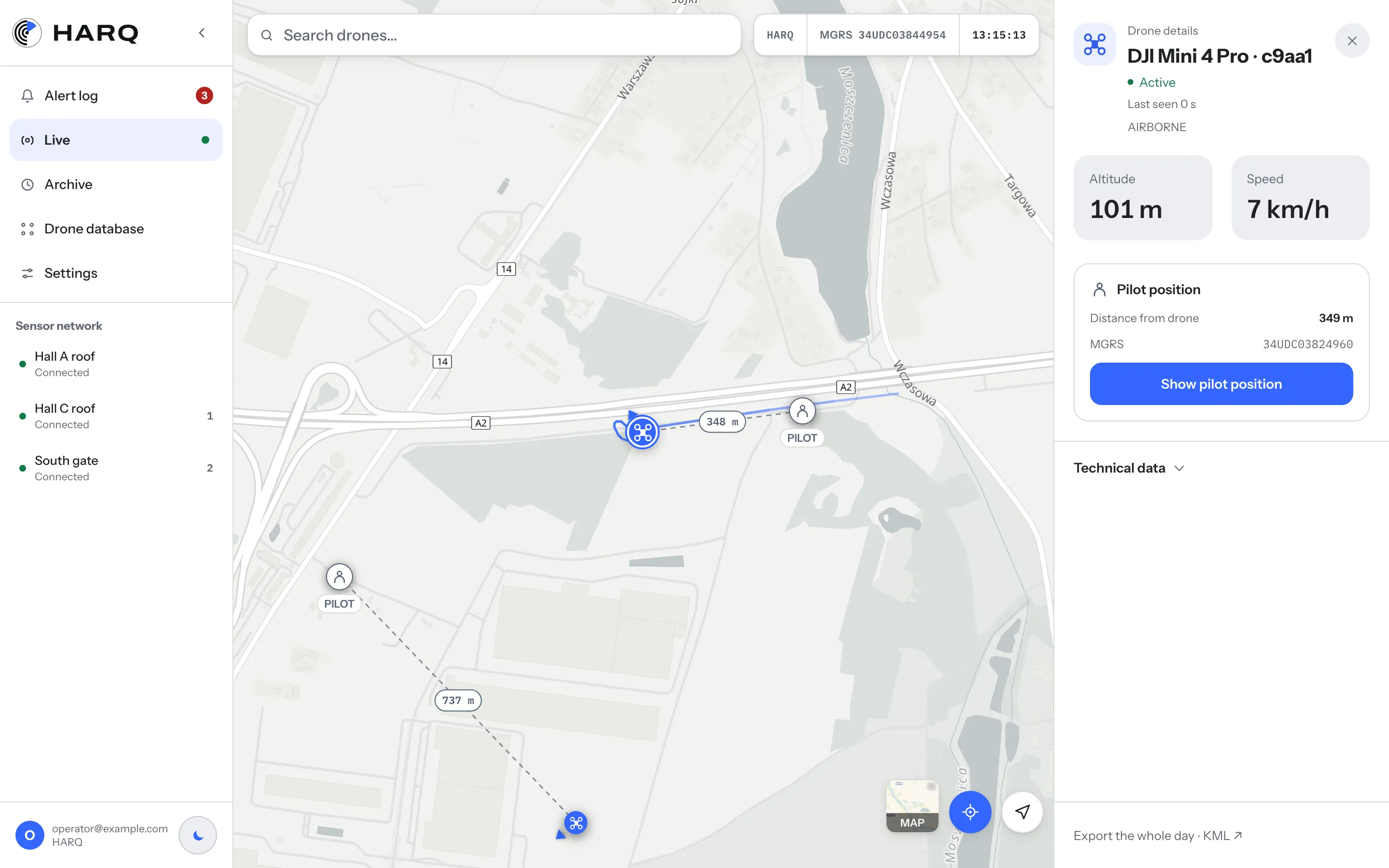
Risk assessments, protection plans and CER Directive obligations need data. HARQ records every flight of a Remote ID drone near your facility and passes alerts to the systems you already use.


What you get
Your first layer of protection against drones.
Data for risk assessments
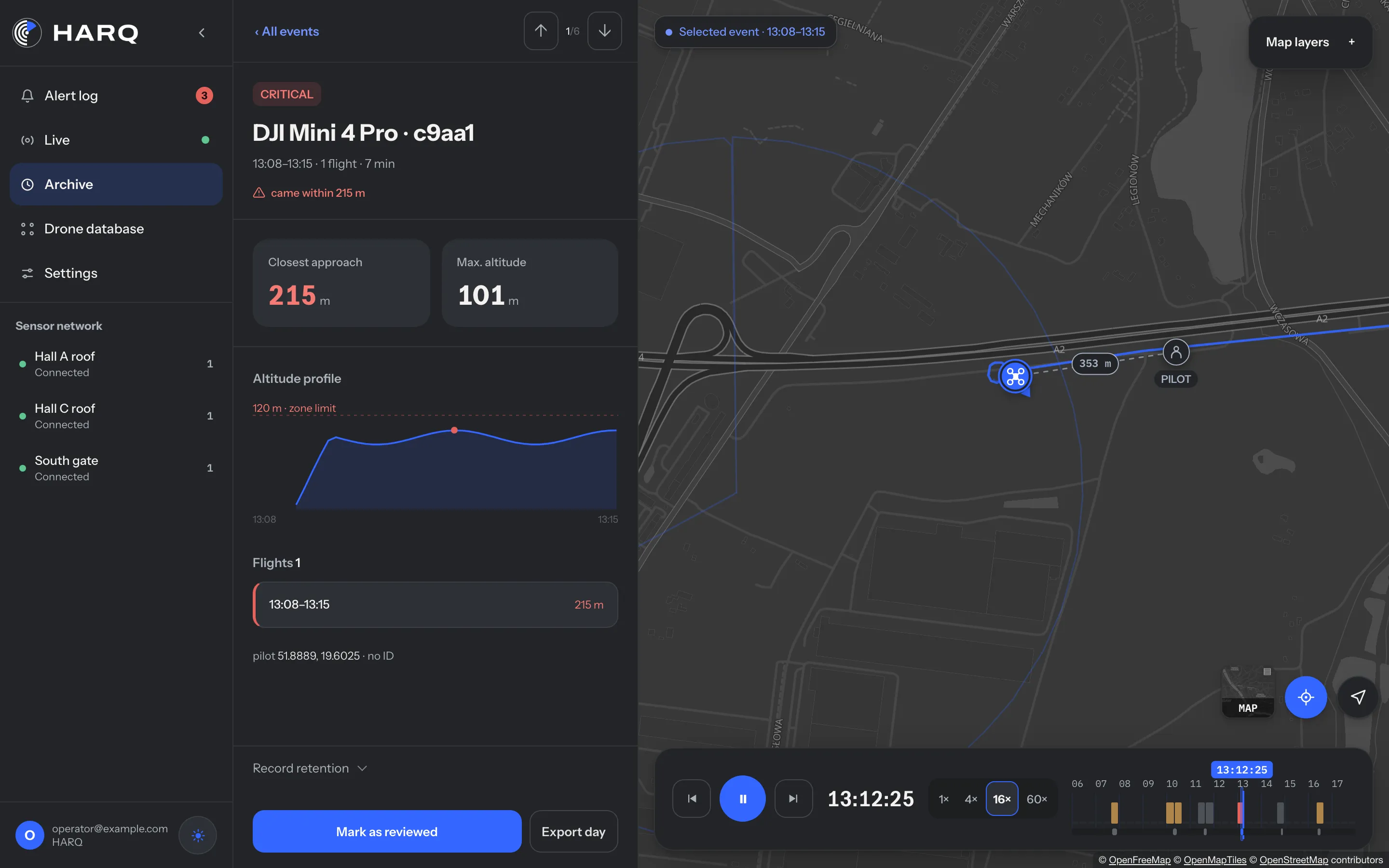
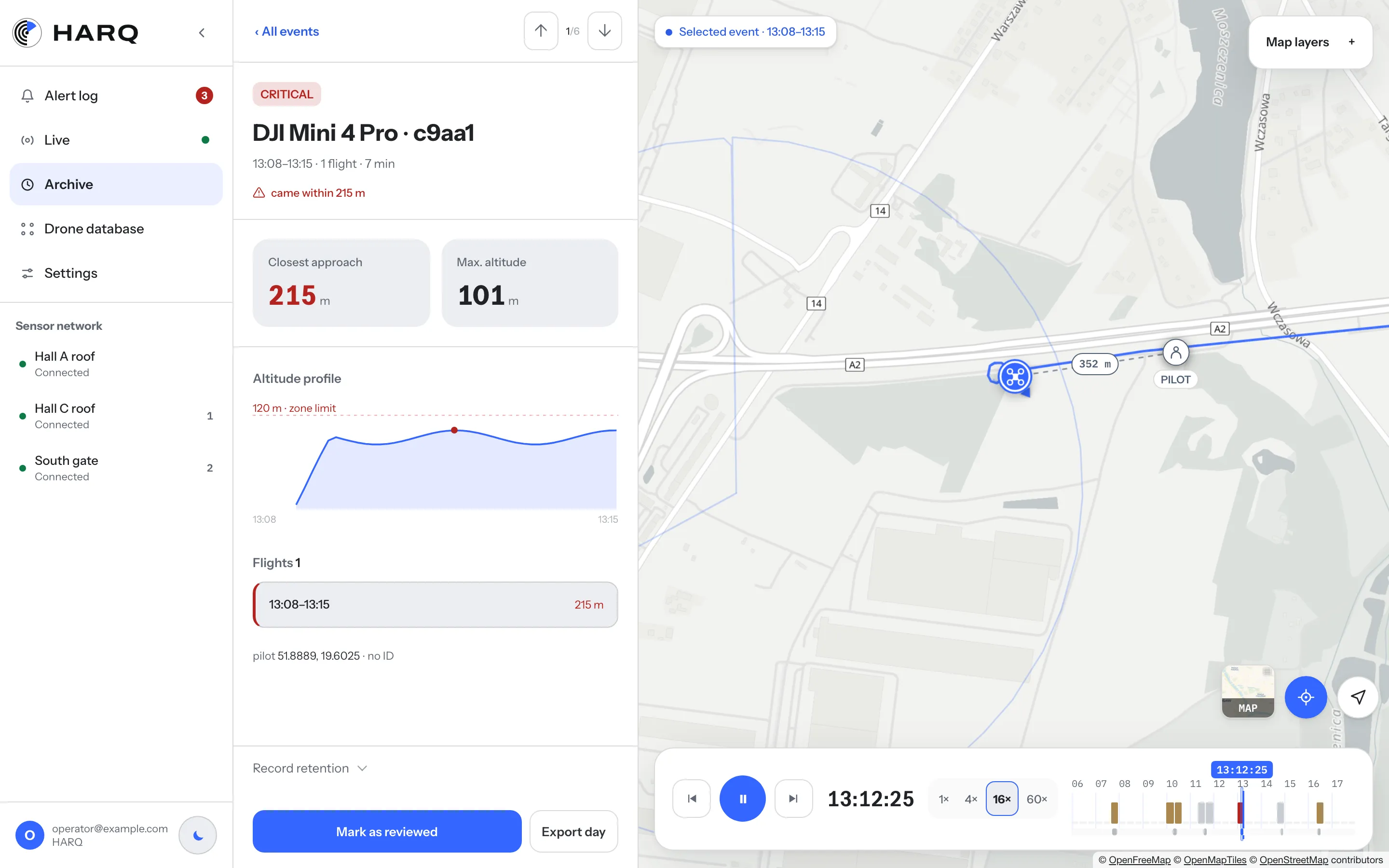
An archive of the last 30 days: flight times, paths and where the pilots were flying from. Export to CSV or KML.
Alerts in your VMS/PSIM
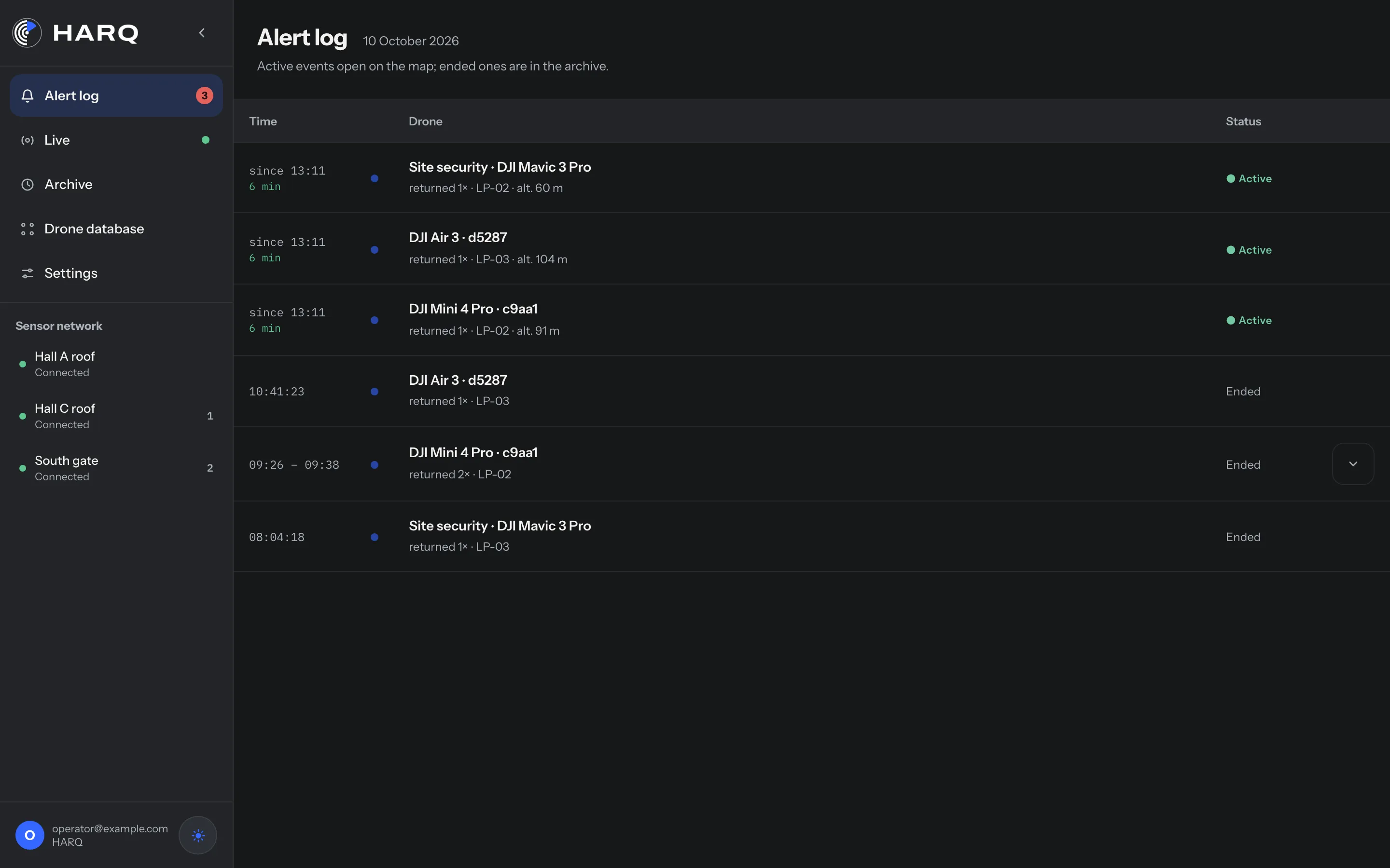
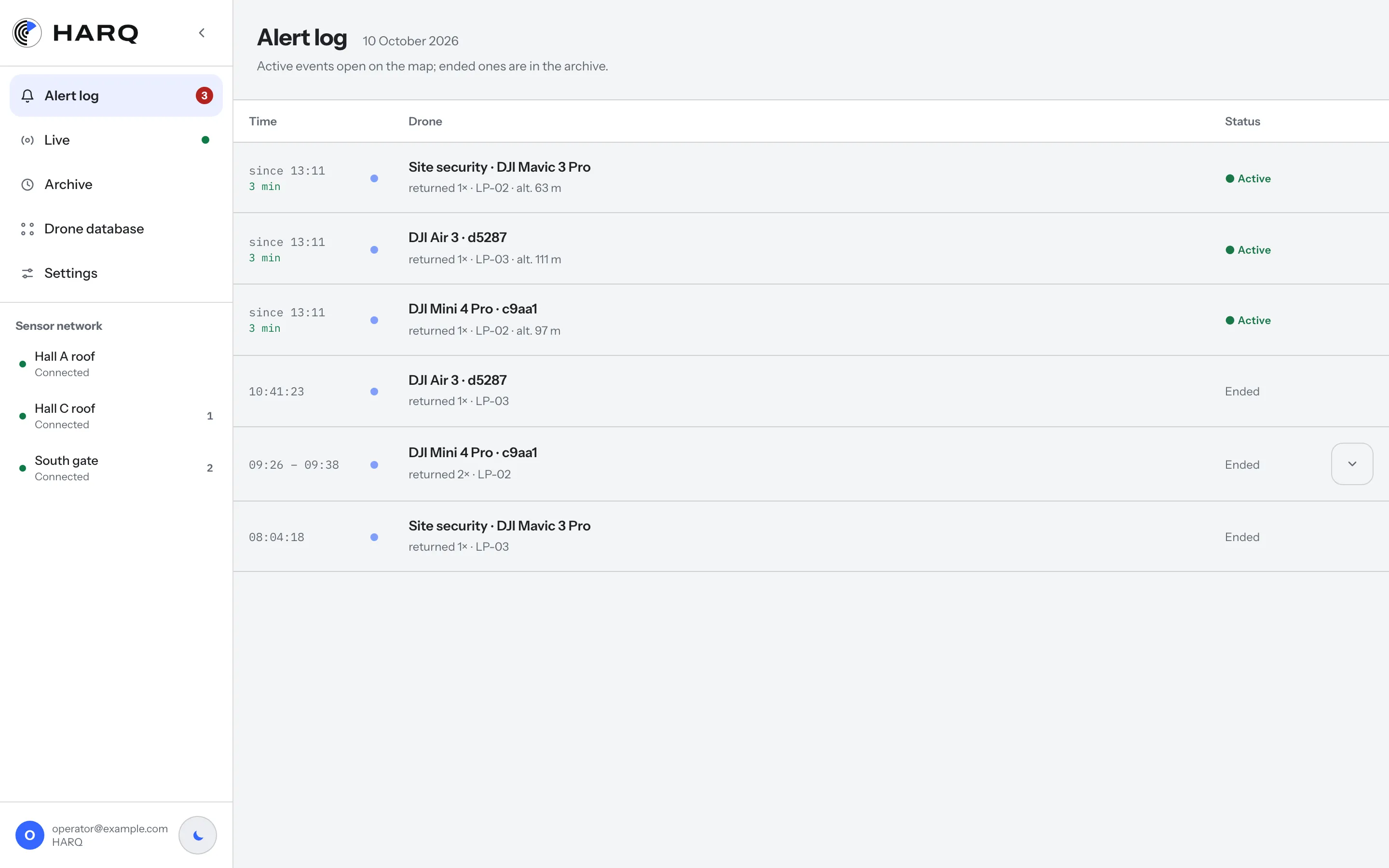
On the Critical infrastructure plan, alerts go to your VMS or PSIM, next to your camera feeds.
Before you use jamming
Since 4 July 2026, a critical infrastructure operator in Poland may authorise armed security guards (SUFO) to use a jammer. But first you need to see the drone and know the pilot’s location.
Honest about coverage
HARQ sees drones that broadcast Remote ID. It doesn't see C0 drones, most FPV drones, home-built drones or drones with Remote ID switched off.
Recommended plan
Critical infrastructure
A critical infrastructure operator, or a critical entity designated under the CER Directive.
- Coverage for the whole site
- Integration with your VMS/PSIM
- SLA and 24/7 support
We set the number of sensors after the site survey. On-premise deployment is quoted separately.
Frequently asked questions.
Critical infrastructure operators can now authorise drone jamming. Why do they need detection?
Since 4 July 2026, a critical infrastructure operator in Poland may decide that armed security guards (SUFO) can use a jammer against a dangerous drone (Article 6zj of the Crisis Management Act). The jammers must be notified in advance to the interior minister, the President of UKE and the military frequency authority, and every use reported straight away. To make that call, you first need to see the drone and know where the pilot is. HARQ gives you that first layer of protection and a record of every event.
What about drones without Remote ID?
HARQ can't see them. They need radar or RF analysis, and HARQ can run alongside such systems.
How long do you keep flight data?
By default we keep the detailed flight record, with the route and the pilot's position, for 30 days, and after 7 days we coarsen the pilot's exact position to about 100 m. Events and alerts stay in the archive for 90 days. An event marked as evidence is never coarsened or deleted.
Who can access the data?
Your team. Each person gets an admin or viewer role. Not even HARQ's own admin panel can open data on flights over your site. We store data on servers in the European Union, and we can name the country in your contract.
Can HARQ run on our own servers?
Yes. We price an on-premise deployment separately. Flight data then goes to your server, and we only have service access to it.
Can a flight record help with a police report?
Yes. The record shows when the drone flew, its route and height, and where the pilot was standing. In the archive you can mark the event as evidence, and HARQ won't delete it. Attach the export to your report. Keep in mind that Remote ID is broadcast by the drone itself and the signal isn't signed, so the record doesn't prove who was flying. That is for the police to establish.
Data for your protection plan after a 90-day trial.
We put a sensor where it matters most, and at the end you get a flight report you can attach to your risk assessment.
Other industries